blah blah blah
Upper and Middle Purgatory Falls
Length: 1.4 miles out-and-backDifficulty (click for info): Easy
Elevation Gain: -150 feet
Rating (click for info): 5/10
Height: 25' (upper)
River: Purgatory Brook
Driving Directions:
Trailhead and parking area are at the end of Purgatory Falls Road in Lyndeborough, NH. To get there, take Francestown Turnpike off Rt. 13, 5.9 miles south of Rt. 136 and 4.9 miles north of Rt. 101A in Milford. Travel 0.1 miles, then turn left onto Beech Hill Road. Drive 2.6 miles to the end of the road. Turn left onto Salisbury Road and go 0.3 miles. Turn left onto Purgatory Falls Road and follow it 0.8 miles to its end, across from Echo Valley Campground, now marked private property.
About the Hike:
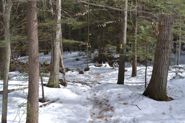
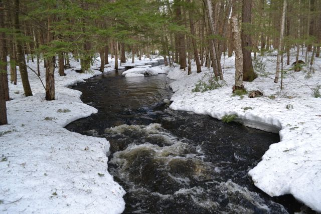
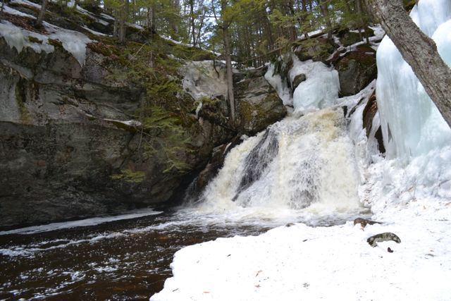
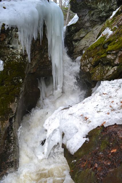
Although not as popular as Lower Purgatory Falls, Upper and Middle Purgatory Falls are more remote and scenic. The trail begins at the end of Purgatory Falls Road. From the end of the road, continue on foot down the unmaintained part, passing a snowmobile trail on the right, then turn right onto Purgatory Falls Trail. The trail meanders through the forest until it reaches a wooden bridge over Purgatory Brook. Pass Janet's Trail on the right. The trail will continue to stay close to the brook until it reaches the upper falls. When you arrive at the top of the upper falls, you will not be able to look down and see it due to a large rock cliff hanging over it. You must continue on the trail, which now leads along the side of a steep ravine between Purgatory Hill and an unnamed hill. After going a short distance past the top, you must descend a very steep spur trail to the base of the falls. Here, you have a good view of the falls and the large pool that it flows into.
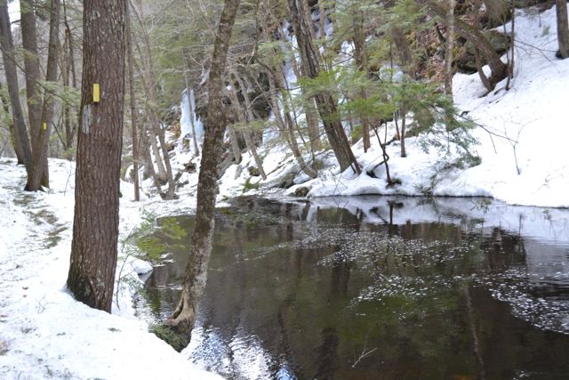
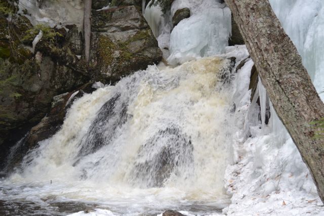
On the side opposite where you stand to observe the falls there is a large rock wall. It forms a barrier on one side of the pool that slowly curves toward the waterfall. The waterfall itself is short and wide, and spreads out over a rock. Continuing on, the trail follows the brook for a short distance before climbing back up the side of the ravine, soon passing East Ridge Trail on the left. It continues along this way until reaching the middle falls, where you must descend another very steep spur. The middle falls can be described as more of a "water chute" than a waterfall. Tucked away in a rock crevice, it is a very unique waterfall. The water is siphoned from the brook into the chute, where it drops, turns slightly, and drops again.
Printable directions page